Dear Suzy,
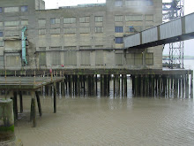
I have just uploaded some pics to flickr (http://www.flickr.com/photos/barbaresiandround/, set: Oxford10/07_postwar architecture). These are photos I took in October when I visited some colleges in North Oxford. I had a guide book listing some of the interesting post-war architecture in Oxford colleges, and followed a short route from Little Clarendon Street, down Walton Street and then round to St Anne’s and St Anthony’s colleges on the Woodstock Road, finishing at Keble college on the Banbury Road.
There is so much architecture hidden from view in Oxford as many of the colleges are surrounded by walls, or centred around courtyards and not clearly visible from the street. I remember that we managed to see some interesting buildings on a visit you and Matt made to Oxford about a year or so ago (a Smithson building in St Hilda’s college and the picture gallery at Christchurch among others), but it takes a bit of research and speaking nicely to porters to get access to some of these places. We’ve talked a bit about our relationship with different parts of the city, and how some areas, either explicitly or implicitly are not open access. It seems as though an important part of our research for this project is attempt to access areas that we might not normally go to and to gain a wider and more interesting relationship with Oxford and Paris.
I’m hoping that when we’ve finished unpacking our boxes I’ll be able to find my guidebook again and visit some more post-war buildings in Oxford. In the meantime I’m interested in exploring the area we’ve moved to in East Oxford. In his book 'Isolarion: a different oxford journey', James Attlee writes about how East Oxford was developed from marshland that was drained in the 19th century. The area was divided up by land societies and, as the land was broken up into small plots, there is lots of variation in the Victorian terraced housing. It seems like quite an organic and democratic way of developing. It would be interesting to find a map showing how the land was shared out. I'm planning to visit the city archives at Temple Cowley to see if they can help.
East Oxford starts from the roundabout at ‘The Plain’, the high street goes west into the city centre, and three roads go east, eventually crossing the ring-road. These are St Clements (which becomes the London Road), Cowley Road and Iffley Road. The River Thames gives another interesting route out of town. I've driven along the Cowley Road to Blackbird Leys which is just outside the ring-road (probably the closest equivalent Oxford has to the banlieu in Paris), but it would be interesting to walk to the estate and get a better sense of how far away it is from town, how accessible it is for a pedestrian, and the kinds of spaces I would pass through to get there.
Must go for now. How are things going in Paris?
Rachel
Subscribe to:
Post Comments (Atom)
No comments:
Post a Comment