Sunday, 29 June 2008
Hinksey Lane and Botley
Dear Suzy
I set off on a walk in Botley which is a suburb on the edge of Oxford. The A34 (part of the Oxford ring road) runs right through the middle of Botley, and although I have visited this area previously to go to Habitat and DIY shops and to hire a van, exploring it by foot gave me access to unexpected corners off this part of Oxford.
I started by walking up North Hinksey Lane which borders a small industrial estate. I expected to find little more than industrial buildings and perhaps a few 30’s housing like the ones on the opposite side of the A34, but found that this is actually a very old village. Mixed into the business premises were very old cottages, and as I progressed along the road I found more cottages, a cemetery and an old manor house. The village has a strange feel, so idyllic with beautiful countryside behind it, allotments and a nature reserve, but this is disrupted by the persistent noise of traffic on the ring-road. There are some odd juxtapositions in the village – Buildbase on one side of the lane and old stone cottages on the other, the functional Botley WI building with glass office buildings behind it. Typical out-of-town premises are meeting an old village and a 30’s estate with a dual carriageway that fractures the area.
There are two subways connecting Hinksey Lane with the rest of Botley. I went through to the other side and found it interesting the way that the ring road has been fenced off in an attempt protect the 30’s housing estate. It feels like the Berlin wall – such an emphatic divide between two halves of a village. You can see my photos on flickr.
I’ve been thinking about the WI building and can’t help feeling that it would be interesting to involve the WI in our project. There may be some interesting histories about the area and the affect the ring road has on the village.
re cowley works bridleway
Dear Suzy,
It does seem odd that BMW prohibited photos of the bridleway. I expect the sign was fairly recent and due to the media attention surrounding the closing of the path. I took lots of photos into the other side of the BMW plant when I walked along Transport Way – there were no signs to stop me there. Perhaps I should ring up the contact number they gave and ask about this?! BTW they also had CCTV along the path. It does seem they have been anticipating trouble.
As for sitting on the fence – with the kind of material we're working with there are so many possibilities for getting involved in local politics! I'm not sure whether I'd want to deviate into getting tied up with local campaigns, but I am interested in stories like this and would like to know more.
It would be good to think that the work we make might play a part in influencing ideas about the areas of the city that we have been looking at. In a sense, just walking in these areas near the ring road makes a comment. Driving has a distancing effect, and I'm finding that the process of walking in areas that I normally see from the car window is changing my relationship with them. I am reminded of a section in Merlin Coverley's book 'Psychogeography' where he talks about the comparison de Certeau makes between those who see the city from above (the voyeurs) and the walker at street level. Coverley says 'the simple act of walking can take on a subversive hue, abolishing the distancing and voyeuristic perspective of those who view the city from above.' I hope our own engagement with these (in many cases) neglected areas will draw them to the attention of others through the work we exhibit and any community projects we take part in.
Périphérique swim
Hi Rachel
Went to Roger Le Gall piscine in the 12ar. It’s right by the Périphérique. 50m open air pool. Was built in the 60’s still got all the fittings, and signs, a bit faded and worn. Appropriately it is surrounded by 60’s/70’s tower blocks. They do naturist swims here twice a week too.
I must find out if it was built before or after the Périphérique? How do the experiences of swimming and driving compare? Is repetitive lane swimming a bit like the circular Périphérique?
Blissful swim. Busy at lunch time.
S
Thursday, 12 June 2008
re Cowley Works Bridleway
Hi Rachel,
I was thinking about your comment on the bridleway and how you can see why BMW would want to close it, as well as seeing the point of view of the residents needing access. Although we are artists rather than campaigners, our work touches on many political issues and we don't necessarily need to sit on the fence.
Also I am interested in the no-photo/video sign. I wonder why? When the homeless man at Saint-Denis saw my camera and was quite aggressive as thought I meant to take a photo of him, it's understandable, as its very personal and to do with pride and his situation, but what was this sign about? Commercial secrets or the representation of the company? It is another kind of prohibition like places you can access or not.
S
Wednesday, 11 June 2008
Ideas so far for Oxford Paris project
Hi Suzy,
These are the ideas we discussed for the exhibitions at Ovada and in a Paris gallery. I hope this is a good representation of our conversation but you can add/edit. I expect (and hope!) the work will evolve and change from this but it is really important to have starting points
1 Postcards. We are working with postcards of Oxford and Paris, editing them and adding to them to reflect aspects of these cities that are not usually celebrated or used to define the city to outsiders. Additions include stitch, collage, painting and relief. These will be put together as a wall installation.
2 Suspended construction. This is based directly on the ring roads. The construction will be made from fabric and wooden batons, making the impressive engineered road systems into something homely and a bit ‘wobbly’. We will create both the Paris and Oxford ring roads to scale.
We plan to make paintings from objects and spaces that we photograph whilst exploring the outsides of the city. These will be placed around the gallery in relation to the suspended construction, creating a sense of the more intimate forgotten elements of the spaces the Périphérique passes through.
At Ovada this would also connect the different spaces in the gallery. The downstairs area of Ovada is divided into a rear gallery, reception area and front ‘shop window’ space.
We will also explore the possibility of creating a scale version of the old Oxford city wall, and mapping the various moves outwards of the Paris city wall, the Périphérique being located on the latest one.
3 Collections. We are doing lots of walking around the cities as part of this project and are collecting objects we find during these walks. We will exchange the Oxford and Paris objects, and make paintings of views/finds in the other city on each set of objects (paintings from Paris on the Oxford objects and paintings from Oxford on the Paris objects). These will be displayed in Oxford and in Paris. Here is an addition we haven’t discussed so let me know what you think: During the exhibitions we could organize a series of walks to return objects to the places we found them. This idea a bit influenced by Hilary Jack who mends and restores objects she finds and then returns them to the place she found them. I think painting on rubbish which then gives the rubbish value, but then returning them so that this is lost and they cannot be valued as objects could be quite interesting. They then become a memory and something that is documented.
4 Community project. Following on from postcards work we will set up workshops with elderly people and create postcards based on their photos – either from their personal albums or photos they take as part of the project. These will be selected and formatted into postcards that reflect residential suburbs and estates around the city. An edition of cards will be produced to sell at the gallery.
There is a precedent for making ‘local’ postcards in Oxford. A Victorian photographer - Henry Taunt – was based in Oxford and published many postcards of streets in residential areas of the city. You can see a few on-line at http://www.headington.org.uk/history/postcards/index.htm
Many are held at the public record office so I will try and get access to them. It would be good to use Henry Taunts images to inform the workshops and contextualise what we are doing. Also the postcards on the caravan gallery’s site have a subversive and playful approach which is relevant to what we’re doing. www.thecaravangallery.co.uk
5 Gateways. Bridges and underpasses to cross ring roads are the modern equivalent of gates in the old city wall. We will document the gateways to Oxford and Paris and put these images together in either one or two artists books.
6 Documenting journeys. We will find a way of documenting all the journeys we have made as part of our research for this project. This is partially happening via the blog and flickr, but we will also map our journeys.
There are lots of possibilities to think about, and no doubt they will evolve or some may be discarded in the process of making, but this is a starting point.
If this sounds different to what we spoke about the other night please add to this or change it!
Rachel
Cowley works bridleway
Dear Suzy,
I went back to the Cowley works today to see if i could access the bridleway. The pavements are being dug up around the edge of the works near to the Eastern bypass and on the Garsington Road. This must be the alternative route that is being created. For the time being the bridleway is still accessible and so Zola and I went along it. You can see from the photo above that they have banned users from taking photos or video, but I thought one photo taken from outside the bridleway would be OK.
Despite being almost asleep in her pram when we started walking, Zola quickly woke up as there were lots of interesting things to see from a toddler perspective. Fork lift trucks were whizzing backwards and forwards to our left moving crates around. On our right car transporters were being loaded up with new minis.
It is easy to see why BMW are so keen to lose the bridleway and amalgamate their two sites. It must be logistically very inconvenient to have a divided site and security is probably more complicated. Nevertheless I felt a lot of sympathy for the people who want to use the path to get to work or to reach Brasenose Woods and Shotover Park. Walking along the eastern bypass is not an attractive alternative and would take much longer.
I was on the Bridleway between 11am and 11.30 am and two people passed me on bikes. It would be interesting to go there at a time of day when people are going to work and see how many people are using the path. I'm also curious to talk to people about how they feel about losing this right of way.
It took me about 10 minutes to reach Horspath Road where Stagecoach have a depot. On the way back I picked up some polystyrene packaging and noted a discarded disposable boiler suit which I will return for (didn't have a bag to carry it in and it looked a bit mucky!). The first finds for our 'collection'.
Rachel
Tuesday, 10 June 2008
Paris City walls
Hi Rachel,
Thinking about the connection between the historic city wall as a boundary and fortress and today's Peripherique, I went to the Pavillion-Arsenal, a museum about the development of Paris and it's architecture.
There have been several city walls, each time extending Paris's boundary outward. Since the middle ages the development of Paris had happened spontaneously around the trade routes, churches and convents. The first city wall was begun by Philippe Auguste in 1190.
Then is 1357 A new wall was started by Etienne Marcel, provost of the merchants. It was finished in 1383 by Charles V and enclosed parts of the north west suburbs. On the left bank the Philippe Auguste fortifications were rearmed and modernised, 6 new bastides were constructed, including Bastille (it seems incredible to imagine Bastille being at the edge of the City) From the map it looks like the wall had a moat around it.
Louis XIV (1638-1715) preferred Versailles, and so liked to keep the city at arms length, investing in the periphery. From 1670 the city began to loose protective fortifications in favour of a boulevard linked to new avenues built across the countryside. The capital became open again to the rest of the territory.
In the 18th century Paris was growing and extending it's boundaries, despite a desire to control the surrounding area with a degree banning construction in 1724, and in 1783 and 1784 others which aimed to check development by designing minimum width of street and regulations on prospect. So a new city wall was built in 1784 by the Fermiers Generaux, tax collectors on behalf of the king. Now their was again an intra-muros de velopment.
The last city wall was constructed by the Prime Minister Adolphe Thiers in 1840. These walls were for military fortification with outlying forts. By the time it was finished it enclosed a number of hamlets outside Paris, among them Auteuil, Passy, Montmartre, La Villette, and Belleville. It was dismantled in the 1920's (I need to find out why) This then became the site for the Périphérique which was built in the 1970's.
I'd like to find out more about what happened to the areas which the Périphérique cuts through when it was built. There were 50 years between the walls being pulled down and the motorway construction so how did that loss of connection play with the residents? I've started walking around the Périphérique and although there are bridges and walkways it is hard to get near it .
S
Friday, 6 June 2008
Cowley works walk
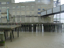
Underneath the ring road with Cowley Works in the background.
Hi Suzy,
I went for a walk around part of the Cowley works today where BMW make minis. This was originally the production line for Morris and many people living in East Oxford worked there.
The works occupies a huge site adjacent to the eastern bypass. At one time the works were also located on the opposite site inside the ring road. This has now been turned into a business park with boxy glass office buildings surrounded by landscaping and manicured lawns. I wasn't sure if i'd be able to cross the junction that connects the cowley works and blackbird leys to the city as a pedestrian, but decided to try. It was actually fine - with pedestrian crossings enabling office workers to get to shops at the nearby retail park.
I followed the Garsington Road, going under the railway bridge of what is (i think) a disused train line. Passing a few random shops and businesses including a barber's and Lidl I turned left into Transport way, hoping to get closer to the Cowley Works.
On the left I passed another clunky glass office building - impeccably maintained - but most other buildings were shabby and semi-industrial. After this I could see the Cowley works from the rear with huge car parks where minis were being loaded onto transporters, and behind this the factory buildings. As I continued walking i passed a gas tower, derelict 70's industrial unit and some other businesses.
AT one time it would have been possible to cross the middle of the Cowley works on an old bridleway that connects Blackbird Leys with Brasenose Farm and Shotover Park beyond the works. BMW gained planning permission to block this right of way at the end of last year. This has caused a big outcry among locals who use the route to get to work, and horse riders.see http://www.iwca-oxford.org.uk/blackbirdleys/news/nws06020.htm
A pedestrian and cycle route is being created along the eastern bypass but apparently there is no provision for horse riders. The eastern bypass is a very long way round as well as being an unpleasant route for pedestrians who say they will now have to drive to work. I've put some more pics up on Flickr.
Rachel
Tuesday, 3 June 2008
Ring roads
Hi Suzy,
I had a couple of other thoughts about the ring road idea.
It might be interesting to make both Oxford and Paris ring road to
scale and display them together so the piece gives a sense of the size
of each city. this started me thinking about the original oxford city
wall which would have included a very small area of the modern city. Maybe we
could work with this as well?
Also I'm thinking about how the city grows in an organic way and its
boundaries can be quite blurred as it grows and incorporates villages
and suburbs as opposed to the ring road which creates a bold and
definite division around the city. I'm interested in the way the ring
road divides up areas and is an artificial boundary and the conflict
between the city's organic growth and the clarity of the ring road.
I've been wondering about ways we might explore this in some
collaborative drawings - perhaps as studies for work we might make in
the show.
Subscribe to:
Posts (Atom)